Search Term Record
Metadata
Name |
Maps |
Number of Archive records |
0 |
Number of Library records |
0 |
Number of Object records |
0 |
Number of Photo records |
4 |
Related Records
-
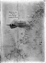
0055 - Print, Photographic
Nautical map of the Maine coast, with inserted view of the Sea View Inn at Biddeford Pool, with latitude and longitude so that cruising yachtsmen could easily locate the Pool and the Inn. Created circa 1910 by Robert H. Gay, probably sold as a postcard by him as well.
Record Type: Photo
-
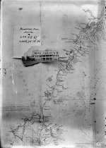
0055a - Negative, Glass Plate
Nautical map of the Maine coast, with inserted view of the Sea View Inn at Biddeford Pool, with latitude and longitude so that cruising yachtsmen could easily locate the Pool and the Inn. Created circa 1910 by Robert H. Gay, probably sold as a postcard by him as well.
Record Type: Photo
-
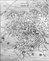
0969 - Print, Photographic
Detailed view of upper Biddeford (downtown area), from the 1856 Map of York County, Maine by J. Chase. [See also library map collections: Map 43]
Record Type: Photo
-
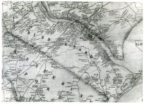
0970 - Print, Photographic
Detailed view of city of Biddeford, from the 1856 Map of York County, Maine by J. Chase. [See also library map collections: Map 43] Shows property owners throughout city.
Record Type: Photo